Showing posts with label How well do you know the old Singapore?. Show all posts

Thursday, May 09, 2013

GMY Book Contest #8 - results


Congratulations to reader, Chew. The correct answer is Jurong Road. My friend James Tann who shared this photo from the 1980s said; “This photo of Jurong West as taken from the Jurong Road roadside at Hong Kah Village. Location should be somewhere near today's Green Haven Halfway House that was beside the old Bulim Cemetery.” 

The sign which I had blurred out actually says; “Bulim Community Centre"

But I am still having trouble pinpointing the exact location because in the 1980s, the PIE had already been constructed; and yet in James’ photo, the HDB blocks looked so near. If this place was indeed near the Green Haven Home, they should be much further away. Anyway, I hope readers can throw some light.
 
From 1981 street directory
Actually, I have blogged about this area before here. In the old days, when we travelled to Safti via Green Bus 175 or 174 to Nantah, we would pass through this stretch of Jurong Rd. However, we were usually too tired or sleeping to note the surroundings. As I mentioned in the earlier article, we also did a lot of topo training in this part of Spore which we called Hong Kah.

Here are a few more photos of Jurong Rd between Bukit Batok Road and Green Haven taken in April 2007.


PS – Chew, pls email your address to me so I can send you a copy of my book.

Saturday, May 04, 2013

GMY Book Contest #8

First to identify this place gets a free copy of my book Good Morning Yesterday.

Photo credit: James Tann
But no prize for identifying the street in this 1960s photo from Tim Light.


Sunday, March 31, 2013

GMY Book Contest #7


Earlier this year I received this photo from my friend Mike Robbins. This is one of the photos taken by Mike’s former colleague at the Naval Base, Ray Kirkman,  in the 1960s. Ray was a keen photographer who took many photos of Singapore during his free time. His son Peter has kindly forwarded some of them to Mike to share with us here on Good Morning Yesterday.

Last week, I received the sad news that Ray has passed away at the age of 87. His legacy lives on here at Good Morning Yesterday.


As usual, the first person to identify this place gets a free copy of my book Good Morning Yesterday which is now available only at Kinokuniya @ Orchard and a few other book stores (too lazy to keep track which ones) as well as Haf Box and Betel Box (see side bar). 

Wednesday, March 06, 2013

GMY Book Contest #6 - Results


With a bit of help from Tim Light, I think we can confirm that Pastimes gave the right answer. This photo is probably of New Bridge Road near the junction with Upper Pickering Street. Tim has also helped me to locate a similar photo dated 19 December 1961 from the National Archives’ Picas website (Photo no. 2) which carried this description.

“Mutinous members of the Work Brigade demonstrate outside the Ministry of National Development Office in Upper Pickering ……..”

Picture no. 3 was taken by me yesterday. I happened to be at the nearby newly-opened Chinatown Point to meet some of my course trainees.
Congratulations to Pastimes. Pls email me your address; or message me at Facebook.


While sniffing around the Picas website, I came across a 1970 photo of the hawker centre in front of Thong Chai Medical Institution at Eu Tong Sen Street. So happens I took a similar shot yesterday and so here’s a Then and Now comparison of the same place 4 decades apart.


Sunday, February 03, 2013

GMY Book Contest #5


Thanks to my friend Stephen Lai for contributing this mid-1960s photo. The first person to identify this place wins a copy of my book, Good Morning Yesterday. Just post your answer in the comments section. Sorry; only local readers can win ….. for obvious reason.

I know the general location of this place but am not 100% confident of the street/building. Even Stephen could not recall the exact location.


######################################
Incidentally, Good Morning Yesterday (Book) was last spotted at Times @ Centrepoint (Tel: 6734-9022), Kinokuniya @ Ngee Ann City (Tel: 6737-5021). You can also get it at Betel Box Hostel, Bistro & Tours (Tel: 6247-7340) and HAF Box Pte Ltd (Tel: 6235-4560).

Tuesday, January 22, 2013

GMY Book Contest #4


Thanks to Geoffrey Pain for sending me this mid-1960s picture some time ago. The first person to identify this place wins a copy of my book, Good Morning Yesterday. Just post your answer in the comments section. Sorry; only local readers can win ….. for obvious reason.


RESULTS

This is what Geoffrey Pain wrote: The subject of the photo is the shop at the end. Hengs which is where my father bought his radios and other items. The shop is in Jalan Kayu just outside the Seletar Base.

Peter Chan, my friend, and regular blogger here at GMY, adds: “Those shops on the left of Jalan Kayu as you approach TPE (then you cross the road bridge over TPE); then before you is Piccadilly Circus inside Seletar Airport.  The famous Jalan Kayu roti prata (in Foodage) opposite to those wooden shops.  Today those wooden shops gone and now an empty plot of land.”

Congratulations to Johnny Chen for being the first to come up with the correct answer to what appears to be a relatively easy one. Pls email me your address; or message me at Facebook.

*******************************************************************
Incidentally, Good Morning Yesterday (Book) was last spotted at Times @ Centrepoint (Tel: 6734-9022), Kinokuniya @ Ngee Ann City (Tel: 6737-5021). You can also get it at Betel Box Hostel, Bistro & Tours (Tel: 6247-7340) and HAF Box Pte Ltd (Tel: 6235-4560). 

Monday, November 12, 2012

Singapore, 1960s – The National Neon Tower by Tim Light


Singaporeans in the 1960s were used to seeing neon advertisements, and for me they added enormously to the colour of urban Singapore, especially after dark.  My favourite was an animated neon sign at Newton circus, which showed somebody drinking something.  I can’t remember what the product was, but the animation consisted of three stages in which the character started with a full glass, then showed it at his lips and half empty, then finally with his head bent right back and the last drops going into his mouth.

As well as neon, there were giant objects displayed on buildings, or by the road.  I remember a giant bottle of Soy Sauce at Bukit Timah Circus, and an enormous jar of Brylcream somewhere. These were some of the things that made Singapore different and interesting.


Does anyone remember the National Showroom Neon Tower at North Bridge Road next to the Capitol Theatre?  According to the remarks at the National Archives Picas website, the National Showroom was opened by the former Minister for Culture, the late Mr S Rajaratnam in 1963.  It was highly controversial, because it was, to say the least, insensitive to its surroundings, and not at all in keeping with the classing buildings that surrounded it.  It was several stories high, and towered above buildings like the Municipal Building and St. Andrews Cathedral.  At night it was fully illuminated, and could be seen for miles. 

Opinion was divided.  The conservative view was that it was a blot on the landscape, and destroyed the historic character of the area.  The converse view was that it symbolised the modern Singapore, and that the old architecture of the colonial era should no longer be dominant.

Who was right?  It’s a matter of opinion. Personally I liked it at the time, but I would probably think differently today. 

What happened to it?  It’s not there today, and if it was, it would itself be dwarfed by other buildings. 

Below are 3 photos from the National Archives Picas collection showing the dismantling of this iconic National Neon tower in July 1974.


Monday, October 29, 2012

ANCHOR BEER – the smooth beer for men (by Peter Chan)


I thought about this topic not because you might have been impressed that I am a hardcore beer drinker: truth is I am not even one.  Rather this beer reminds me of my frequent commuting by car as a young lad.  Frequent commuting sharpened my sense for road directions as well as a good memory for places.  Since my father was the driver, I sat next to him looking at the way he managed the steering wheel, gears and pedals but I would say most times this got to a point of being very boring.  So my eyes would turn to things outside the car window.

Every week, we visit my grandparents who lived in the pre-war Tiong Bahru S.I.T. Estate.  Tiong Bahru is quite a long distance from where we lived in Upper Bukit Timah Road.  From my memory, I recall taking three different routes from my grandfather’s abode to our home.  Two of the routes went through the Alexandra – Queenstown, Alexandra - Ayer Rajah Road areas and the third was through a “rich man’s area” - Botanical Garden and Holland Road.

Plate 01: Sketch-map of travel journeys from Tiong Bharu Estate to Upper Bukit Timah Road.

 When Jalan Bukit Merah was opened in the mid-1960s, a fourth route was added.  My father was never known to be a flexible person; there would never be a fifth, a sixth or any other alternative routes when there was one.  It always had to be the same for yesterday, today and tomorrow (even when I got my driving licence and became the “driver”).

This reinforced my memory of prominent landmarks, one of which was the Archipelago Beer Company, whose famous brand was ANCHOR beer.  In the light of the recent corporate take-over of TIGER BEER, we must not forget ANCHOR.  According to my father, ANCHOR had its factory in Alexandra Road before WWII.  What attracted me to the landmark was the good-wagons belonging to the Malayan Railway (now KTM Bhd) at the bonded customs warehouses.  Today the warehouse is now occupied by IKEA Furniture.  The factory was on the opposite side of Alexandra Road, now the Anchor Point and The Anchorage condominium.  Beer was produced at the factory and moved across Alexandra Road to the bonded customs warehouse using the concrete overhead bridge.

Photo 01: Canned ANCHOR Beer.  Nice when chilled.

Photo 02: ANCHOR Beer’s factory at Alexandra Road (c 1952).  Factory on the right, warehouses on the left and the overhead concrete bridge across Alexandra Road.

I would see workers loading crates of beer into the good-wagons and a locomotive would bring the fully loaded good-wagons to Tanjong Pagar Railway Station.  The railway siding crossed Jalan Bukit Merah and vehicular traffic stopped because the safety wooden level crossing was in place.  Today if you visit the empty plot of land between IKEA Furniture, you can find remnants of this railway siding. 

Now here’s a bit of mystery for me.  Maybe someone can crack this mystery and we all can know the answer. 

Recently when I visited the National Archives in England, I found something “unusual” about an aerial photo of the Alexandra Road area (Photo 03).  It not only showed the ANCHOR Beer factory with its unique guardhouse (now a restaurant in Anchor Point) but Nissen huts and  the railway siding as well.

Photo 03: Aerial Photo showing the future Rumah TInggi area [bottom] and the ANCHOR Beer factory and the guardhouse [left-middle] c 1947


Though I am showing one portion of the Alexandra Road area nearer to Queensway, I can tell you this railway siding is longer than the one that terminated at the ANCHOR Beer warehouse.  It ran into Leng Kee Road (which never existed during WWII), across Tanglin Road into Belvedere Close, and finally ending at Prince Charles Crescent and Prince Philip Avenue (which never existed by name but only for the grid layout of roads). 

When the British Army pulled out of the Alexandra Road area in 1949, they turned over military properties to the Singapore Improvement Trust (S.I.T.).  The rest is history as S.I.T. built post-war estates at Prince Charles Crescent, Strathmore Avenue and Dawson Road in the mid-1950s.

Can I hear some answers soon?

Monday, November 14, 2011

Old roads quiz (2) - Bus terminus

I think some of the readers who have been making comments at this blog lately should have no difficulty identifying this place. Hope it triggers more memories for you.


Photo courtesy of Peter Chan

This is a photo of the former Princess Elizabeth Estate School taken in in 2007. Is this the same place as that in the black and white photo? Hope readers can provide more details.

#########################################

But how about this one? I think this one is not so easy.

Photo courtesy of Geoffrey Pain. Below is a close up on the ticketing hut - where bus conductors submit their collections and collect their tickets. The words say, in both English and Chinese; "Tay Koh Yat Bus Co. Ltd". The sign on the white bus says "12" and "Shenton Way".

The words on the side of the front bus says; "Paya Lebar Bus Service".


########################################

Just received this photo from Russ Wickson (16 Nov 2011)

Friday, July 09, 2010

Hotels Quiz

Looks like my quizzes are too simple to stump the old-timers like Peter and Philip. I shall have to up the ante a bit.

Continuing with the 1961/62 magazine, Singapore – A Guide for Businessmen and Visitors; there were 5 advertisements of hotels in Singapore. Two of them, Goodwood Park Hotel and Orchard Hotel are still around. Here’s quiz to test your knowledge of the other three.

Hotel No. 3. Let’s start with the easy one. What was the name of this hotel?


Hotel No. 4. Where was this hotel located? What is standing there now?


Hotel No. 5. What was the name of this hotel which used to be at the corner of Trafalgar Street and Rambau Street?


Wednesday, May 12, 2010

How well do you know your Singapore?

Whilst waiting for my next article, perhaps you guys would like to take a shot at this quiz. What is this thing and where is it found in Singapore?


Wow .... you guys are good. Barely half an hour and the right anwers are given. Hope you can read the explanation below. I should have cropped away the surrounding.

Monday, November 09, 2009

Old Beauties Quiz (7)


Can you identify the old beauty in this photo? Eh …… I am not referring to the two-legged one, though I must say that my old friend Peh Seng Ket looked rather dashing.

I am also very curious about this place. It looks terribly familiar but unfortunately my friend Peh cannot remember where this photo was taken.

Friday, May 29, 2009

The old Pioneer Road


Here is the answer to the Old Roads Quiz (1).

This road was part of Pioneer Road near the junction with Tanjong Kling Road. I took this photo recently when I happened to stop at the SPC station for some petrol.

This petrol station used to be a BP station. Unless you are very young, you’d probably know that at one time, BP used to operate a number of petrol stations in Singapore before they sold their entire fleet of stations to SPC, the Singapore Petroleum Company.

This BP station was located near a sharp bend in Pioneer Road. Here is a 1981 map of the area. Can you spot the changes?
1) A part of Pioneer Road was straightened and joined to Jalan Buroh to form a straight multi-lane highway. Instead of a sharp bend in the road, it is now actually two roads at right angles to each other at this new traffic light junction. But both roads are called Pioneer Road.

2) Tanjong Kling Road has been shortened and part of it ‘taken over’ by the new Pioneer Road. Thus a short stretch of the old Pioneer Road has become redundant and fenced up.

In the old days, this stretch of Pioneer Road was a very dangerous place with high volume of heavy vehicles (traveling at high speeds) and no central road divider. It was also a bottle neck with many vehicles waiting to turn right into Tanjong Kling Road.

Can you guess what road is in the photo below?

It is Liu Fang Road viewed from Pioneer Walk. I took this photo this morning. As you can see, tremendous changes have taken place. There used to be many old factories here. One of them was called Guthrie Engineering. While waiting to get re-enlisted into national service, I spent few months doing a temporary job there. This factory, which manufactured electrical switchboards, wanted to fine-tune their costing system. So they hired me and another fresh Industrial Engineering graduate to do time and motion studies and set standard times for their operations. The factories have all been cleared and lots of civil engineering works is going on.

I also remember this place because it was where I did my 10 km running test during the final days of my OCS course in Safti. I have described this before here.

In the seventies, as you approached Pioneer Circus, (no AYE or fly-over in those days) you will see 2 big factories on the left. One of them is Black and Decker. What is the other one?

Hint: It belonged to a well-known US multi-national company. At that time, they were the biggest investors in Singapore, having (if I recall correctly) a total of 7 plants in Singapore. Do you know the name of this MNC?

I give you a hint. The plant in Pioneer Road was known as XX Hermetic Motors, and they had a plant in Toa Payoh called XX Consumer Electronics. The Toa Payoh plant was located somewhere near the present SPH complex.

Answer: GE or General Electric.

Well there you have it – a history-cum-geography lesson of the old Pioneer Road. I must say, I am a bit disappointed that none of you got the correct answer to my quiz in spite of the many hints. Let’s hope you do better next time.

Saturday, May 23, 2009

Old roads quiz (1)

When lazy old buggers bloggers (like this chap) are too busy to update their blogs, what do they do? They put up a quiz lor!

But I am not so lazy as to simply ‘plagiarize’ somebody else’s ideas. So I have come up with a new category of quiz called Old Roads Quiz. You have probably seen my Old Beauties quizzes, Old Roundabout quizzes and Old Building quizzes. So what is an Old Roads quiz?

You know; our Singapore gahmen is so hardworking. When they are not digging up the new roads which they have just re-dug a few months before, they like to straighten them or even totally remove them so much so that many of the roads that were once so familiar to oldies like us seem to disappear overnight. But sometimes we are lucky. They leave behind a short deserted stretch for us to blog about. One example is this short stretch of (Old) Holland Road which I blogged about here.


Here is another example. Can you please tell our readers what was the name of this road. Hint: It is in the Western part of Singapore.

Hint #2: (now surely Philip Chew will know the answer) - It is quite near to the Second bridge that I 'blew' up

Hint #3: I took this photo from the entrance of a petrol station.

Remember this stretch of the road is no longer in use. In fact it is fenced up. I took the shot from an opening in the fence. It used to run in front of this petrol station and it was a very busy road with lots of heavy vehicles using it!

Thursday, October 16, 2008

How well do you know the old Singapore? - Middle Road

Recently, my fellow blogger, Ordinary Guy has been reminiscing about the Middle Road area. He made mention of places like the David Elias Building, Selegie Complex and Middle Road Church. However, he has missed out one important landmark which was located at the junction of Middle Road and Prinsep Street. Do you know what place I am referring to? I give you a hint. It was a government department.

Today, this place is occupied by a new shopping complex called Sunshine Plaza. The photo below shows the Sunshine Plaza viewed from of Middle Road.


But next to it along Prinsep Street, another old building has survived the bull dozers. Can you recognize it? It’s the Elections Department.

Just across Middle Road, nearer to the David Elias Building that Ordinary Guy mentioned was a building which used to be a hospital. This was one of two hospitals that carried an unpleasant stigma with it in the old days; so much so that the other hospital, the Woodbridge Hospital in Yio Chu Kang was recently renamed the Institute of Mental Health. The Middle Road Hospital was famous for treating VD or venereal disease.

Today, the building which housed the Middle Road Hospital is still standing. Below are two photos I took of it. The top one was taken around middle of last year and the bottom one just 3 months ago.

OK. Enough of digression. Have you figured out the name of that government department I mentioned earlier? The answer is: ROV or Registry of Vehicles.

I remember visiting the ROV in December 1980 when I bought my first car, a second-hand Mazda323. Usually buyer and seller would meet at the ROV, do the paper work to transfer the car ownership and hand over the log book and money. My car was only a few months old and had an EM number plate. I think the number was 8641 or 8461. I paid about $17,000 for it.
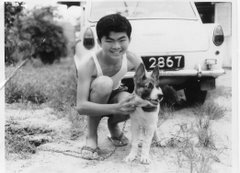
I believe it was one of the first ‘hatch-back’ cars on the roads. It had only a small engine of about 990 cc capacity although the car body was quite big. I remember one occasion when we had a visitor from a (Philips) sister plant in Argentina. This chap was huge .. weighing easily more than 200 lbs. About 5 or 6 of us cramped into my Mazda323 and the car almost could not make it up the Benjamin Sheares Bridge.

Talking about Mazda cars, do you recall the Mazda Capella with rotary engine? I am sure Peter would know about this car. My colleague at Philips, Bobby Yee used to own one. It was a very powerful and fast car. Once we drove to Kuala Lumpur and Kuantan in his car. When we stopped at a motor car workshop in Kuatan, some people came around to admire his car and somebody remarked that it was even faster than the Alfa Romeo.


This old photo from the collection of the National Archives of Singapore shows a section of Middle Road with many old shops. It looks very familiar but I can't quite identify the exact location. Hope somebody can enlighten me. Thanks.